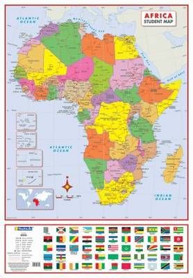
Africa Political Poster Map In Tube - 1:10 000 000 (Sheet map, rolled, 2nd edition)
The Africa Political Tube Poster Map is a colourcoded map of the African continent which indicates major and secondary cities and towns as well as major roads. Included are inset maps of Azores, Cape Verde, Seychelles and Mauritius, and a panel showing the flags of all the African countries.
The wall map is not only educational, but very decorative as well. Great for classroom display or at home. Ideal for young or old and a great interactive activity.